
off
Val d’Assa
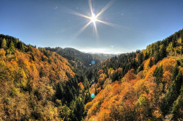
Val d’Assa (ph: Roberto Costa Ebech)
“Among the stones, broken arches, pieces of scale, bell-pins, he also saw bells’ fragments. He picked one up. It was heavy and it had friezes of fusion. His father stood a little lost in thought, then he asked for the piece, weighed it, and stared at it as if inside that bronze there was something to read: “Think” he finally said to his son, “they were melted in Verona and to go up to us there was still no road. It’s been a hundred years. They made a road on purpose along the Val d’Assa, the Clockenbech, and the imperial commissioner was a certain Angelo, our fellow townsman.”
“To go to Roana people had to go down and then up the Val d’Assa because the bridge, for the construction of which the Togna Turca had been so epically fought, had been blown up in May 1916 in order to make more difficult the way to the invader.”
From “L’anno della vittoria” (The year of the victory)
The context
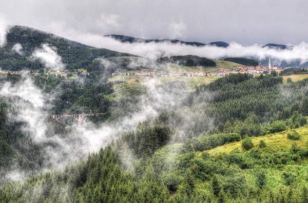
The Val’Assa and the bridge of Roana (ph: Roberto Costa Ebech)
The setting of these two passages is the Val d’Assa, which – like a small canyon – starting from the Piana di Vezzena crosses for 25 kilometres the western part of the Asiago Plateau, dividing in two the municipality of Roana, skirting Rotzo and finally joining with the Valle dell’Astico. In the first passage the Schenal family have just returned to Asiago from the escape, and wander disconsolately along with the other villagers on the huge pile of rubble to which the village is reduced. In the second, some men of Asiago reach Roana for a meeting of a socialist leader, travelling along the old road that went down to the valley floor, and that starting from 1906 had been superseded by the construction of the new bridge (reopened only in 1924).
The route

Petroglyphs in the Val d’Assa.
The main route (CAI path 801) is of great landscape and archaeological interest, thanks to the presence of some caves in which the remains of prehistoric animals and thousands of rock carvings of various ages were found (the oldest have 3500 years), concentrated mostly on the vertical walls of the left side, at the bottom of the valley. The Val d’Assa, for many months the front line between the two armies, was the scene of fierce battles between 1916 and 1918, of which there are several traces (Cima Tre Pezzi).
The sites of the engravings can be reached either from Roana, taking the muletrack that begins at the curve of the road for Asiago, 400 metres from the town centre, or from Canove through the old track that starts a few metres from the church (path 801). In both cases, the descent (about 200 metres of difference of level) takes half an hour. Once in the valley floor you go up the river bed and beyond the didactic area, until reaching in about ten minutes the graffiti area of the Tunkelbal (dark wood), which can be visited only with a guide, after contacting the Pro Loco of Canove (0424.692035 – 692282).
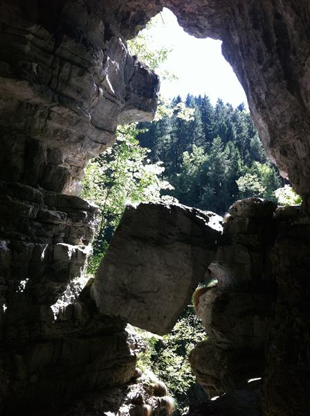
Leute Kubala (Cave of the people), in Bisele locality.
Turning back towards Canove, 150 meters from the valley floor, take the muletrack to the right that leads down to sant’Antönle (m. 775), where the route goes up quickly, with two possible detours to Canove (Ambrosini district), or to the Romita (another interesting area of engravings). Continuing in the woods along the valley you then reach the Bisele and, circumvented Cima Tre Pezzi, you enter the dirt road of the valley of Ghelpack. Going back up, on the right there is the steep path that descends to the Leute Kubala (Cave of the People, spectacular, but only for experienced hikers) and then the striking natural projection called Schaff Kugela (Shelter of the shepherds).
Shortly after you reach the bridge over Ghelpach, on the provincial road; crossing it you can walk up to Canove through the Holla and Busi districts (tot. 3:50 hours, excluding visits). Instead, the route of the bells, which reached the Plateau from the Val d’Astico and went beyond Rotzo and Roana, at the Laghetto takes the road of the Giamolo and after about 250 metres goes down to the valley with a steep path through a picturesque beech forest. Going down briefly in the rough bed of the creek you cross the road to the left that goes back comfortably to the current provincial road for Trento north of the Tagliata (see route Dosso-Manazzo), where you should leave a car of support.
